
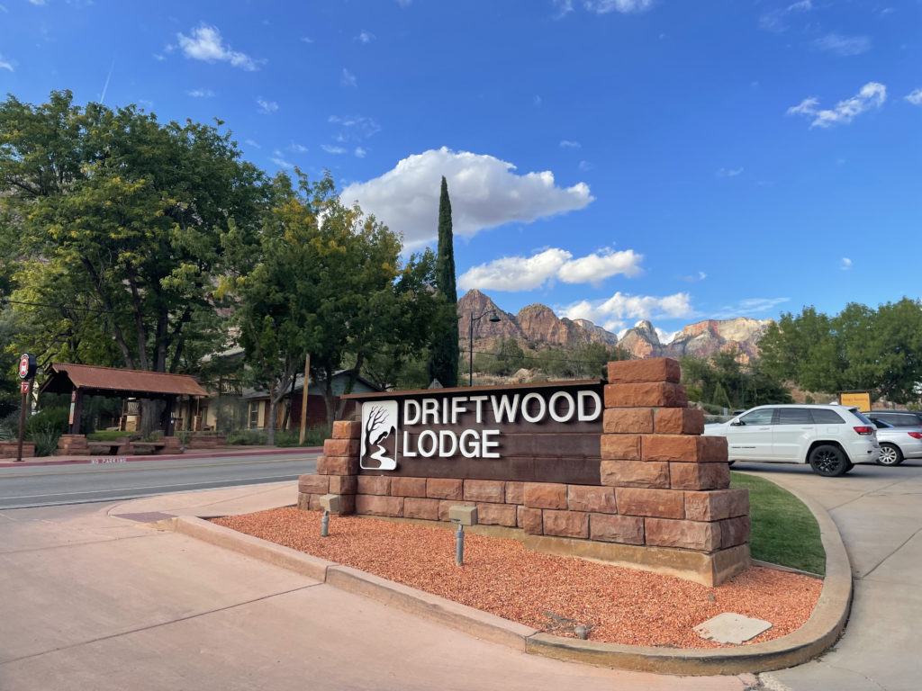
I will start off by saying that four nights (and three full days) is not nearly enough time to fully experience Las Vegas, Bryce Canyon, and Zion National Park. But, as far as packed itineraries go, I maintain that ours was pretty perfect. We flew in from New York and arrived in Las Vegas on a Thursday night, picked up our rental car, checked in to the Paris Las Vegas Resort & Casino, walked around the Las Vegas strip a bit, tried our luck in the hotel casino, and then headed out after brunch the next morning to drive about 2 hours and 45 minutes to Springdale, Utah, the charming cluster of hotels, restaurants, homes, and gift shops that serves as the gateway to Zion National Park.
Hiking in Zion National Park
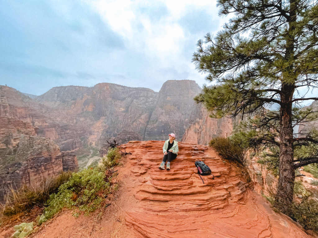
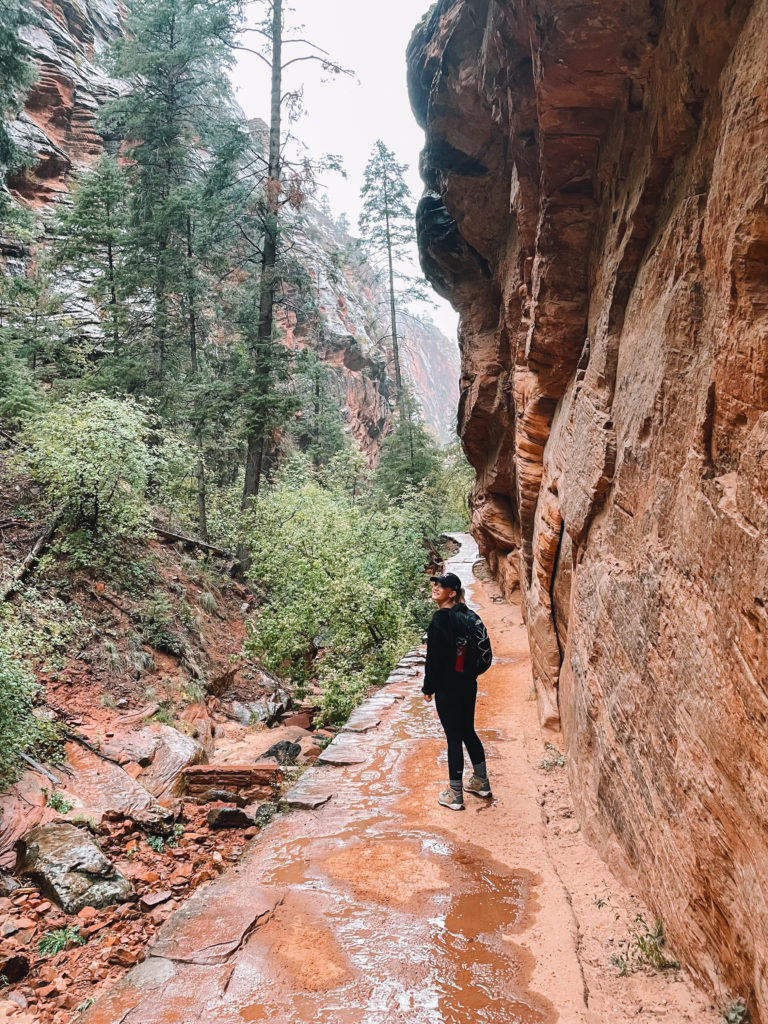
West Rim Trail
AllTrails – Scout Lookout via West Rim Trail (3.6 mi) – note: we went a mile or two past the stopping point for this trail along the West Rim Trail.
1,115 ft elevation gain | out & back
Difficulty: Hard
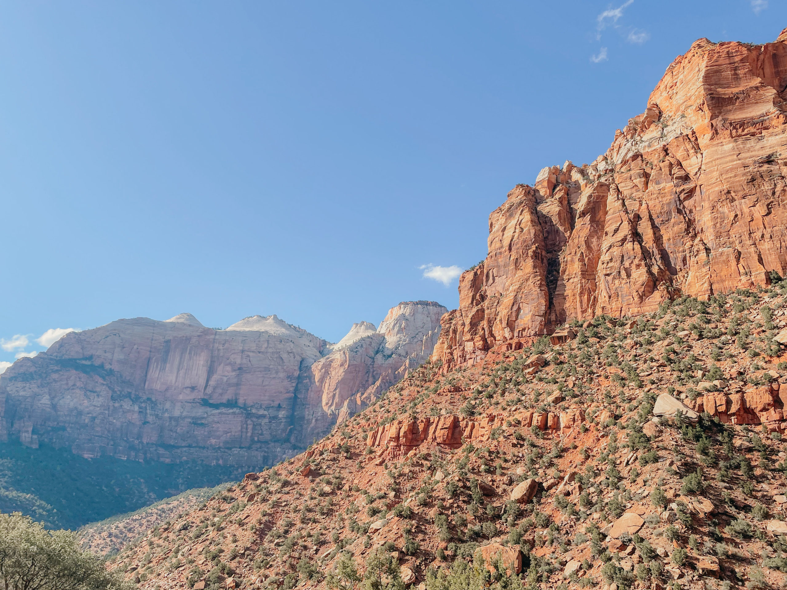
Bad weather did not detour us from exploring all that Zion has to offer on our first full day in the park (having arrived in Springdale the previous day after our brief stay in Vegas).
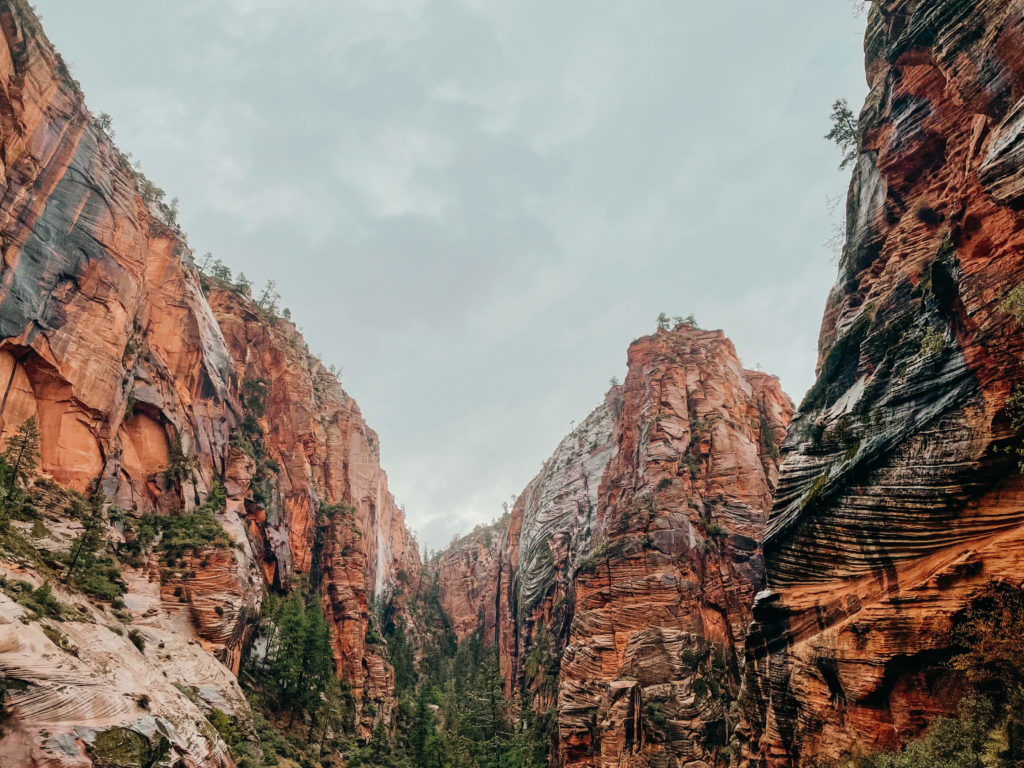
Originally we had planned to hike Angel’s Landing, but it was a definitive no-go in the rain, seeing as the rocks were super slick. We took the park shuttle from the Visitor’s Center to the Grotto shuttle stop and ended up hiking up the West Rim Trail to Scout’s Lookout and then eventually past Angel’s Landing rather than taking the fork in the trail leading over the treacherous outcropping. Instead, we got a bird’s eye view of the famed, much-Instagrammed Angel’s Landing from higher (and more safely) up the West Rim Trail. The views were equally stunning, but less precarious. We turned around when we were too cold, wet, and tired to go any further (theoretically you could keep following the West Rim trail for a full 15 miles). In spite of the weather, this was one of my absolute favorite days of hiking to date – but exhausting! Be prepared for the Walter’s Wiggles switchbacks!
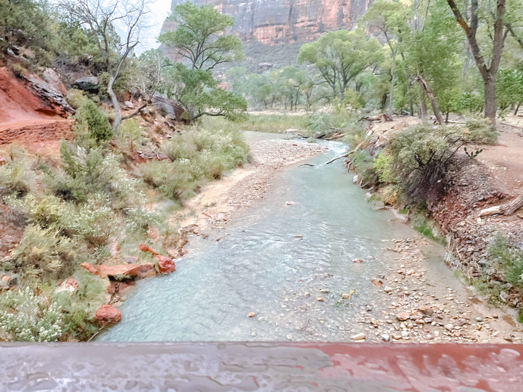
If you’re in Zion on a rainy day, don’t let it discourage you! It’s worth it to take a hike in the rain (so long as you’re avoiding areas susceptible to flash flooding, like the Narrows). We saw countless waterfalls cascading down the sides of the rocks from all around, and it was pretty magical.
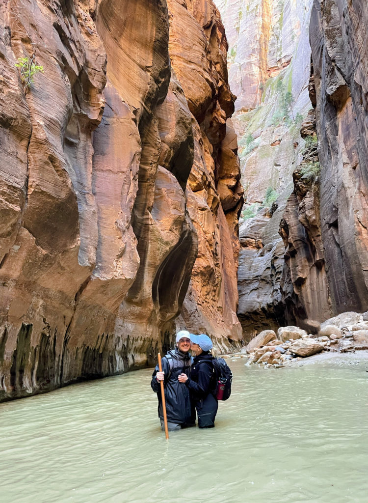

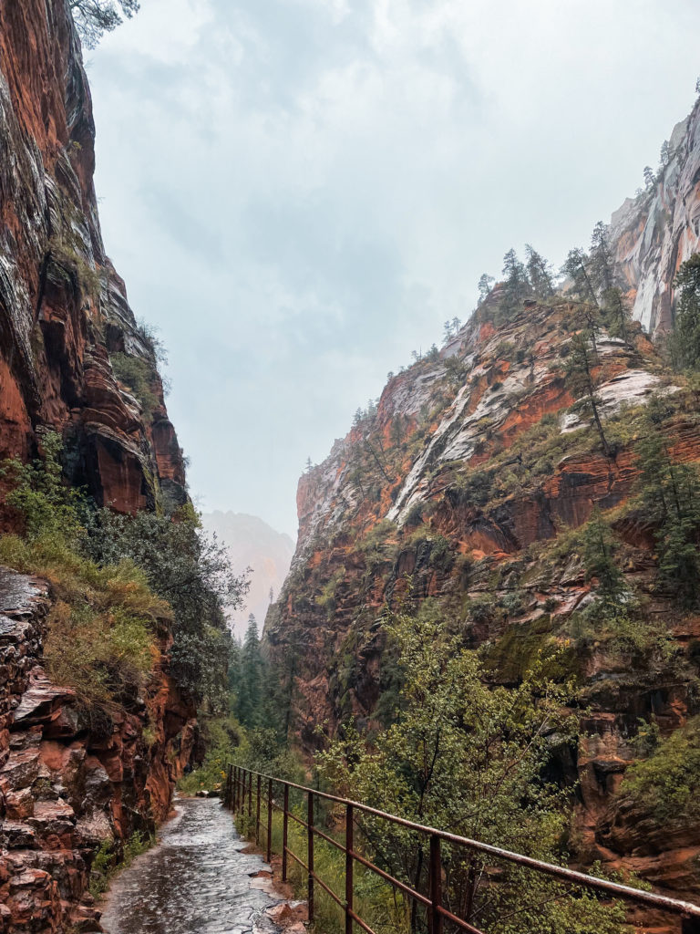
The Narrows
AllTrails – Zion Narrows – Bottom Up to Big Springs (8.9 mi) – we did about 6 mi total
695 ft. elevation gain | out & back
Difficulty: Hard

One of the most unique (and uniquely challenging) trails we’ve even been on, The Narrows are a huge draw for adventurers from all over the world. It’s unusual in the sense that it’s not so much a “trail” as, well… a river. The magical blue-green Virgin River winds through narrow canyons carved by the forces of time and water, and hikers at Zion National Park can follow the river’s path through towering slabs of red rock — that is, if willing to wade through strong currents and murky water that is, at times, waist-deep (or higher! Water levels and flow rate change depending on weather and season).
Our second day in Zion National Park was the day after a torrential downpour, so the Narrows were closed due to the high water levels, extremely swift current, and risk of flash flooding. Luckily, the trail reopened on our last day in the park, but water levels were still higher than usual and the current was powerful enough to bowl both of us over at one point or another. It’s easy to make a misstep when fighting against the current; Dillon and I both tripped on unseen rocks in the clouded water and plunged into the water (which was pretty dang cold in October when we went). Luckily, we came prepared with walking sticks and waterproof socks and boots rented from Zion Outfitter. Dillon also had waterproof pants, which I ended up being pretty jealous of. I highly, highly recommend renting a walking stick or, at the bare minimum, bringing along your trekking poles if you have them. It’s a crucial tool for gauging the depth of water as you proceed carefully along the route, as well as feeling for any large rocks in your path; critical if you want to stay upright!
This hike is an out-and-back trail, so you can turn around whenever you get tired. Just be aware of your mileage, as you’ll have to get back, too, and this trek can become especially difficult when you’re extremely worn out. The Narrows are jaw-droppingly beautiful, super cool, and rewarding to explore, but the trail is also a cold, wet slog with very little dry land. The Narrows can also be incredibly dangerous, so be sure to check the current conditions on the National Park Service website before you head out!
Hiking in Bryce Canyon National Park
A trip to Bryce Canyon by way of Zion National Park is worth it for the scenic drive alone – take the Zion-Mount Carmel Highway / Utah State Route 9 north for a two hour drive unlike any you’ve ever been on to hop from one magical park to another. You’ll drive through the Zion-Mount Carmel tunnel – an impressive feat of human engineering completed in 1930 – and emerge on an entirely new side of Zion, which we wouldn’t have seen had we not taken the trek up to Bryce Canyon, having stuck primarily to the Zion Canyon region.
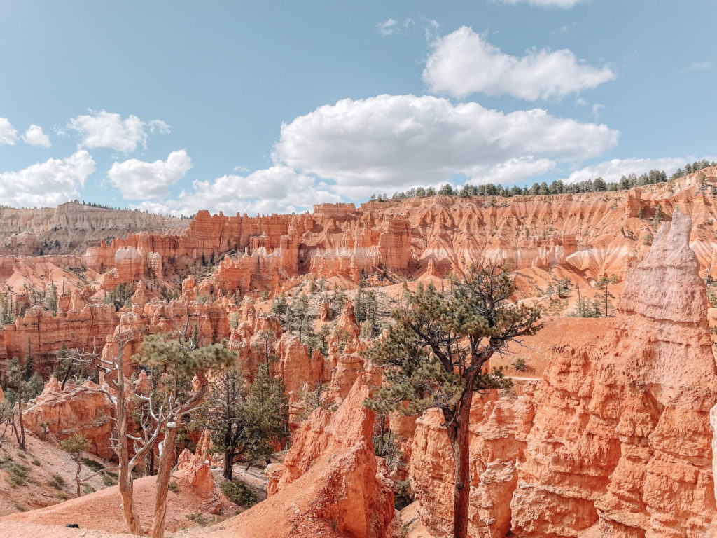
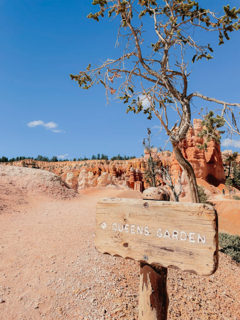
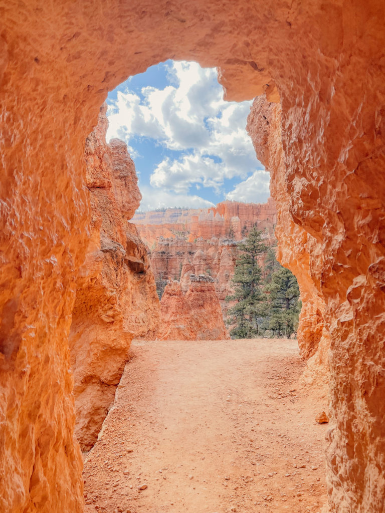
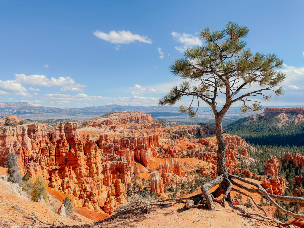
Bryce Canyon is a relatively small park that is easy to see in a day, making it a great candidate for a day trip from Zion. During our day at Bryce, we drove up to Sunrise Point and got a beautiful overlook of the entire “canyon” (technically it’s not a true canyon) before hiking down the Navajo Loop to the familiarly-named Wall Street section of the trail, and then on to the Queen’s Garden Loop trail. We more or less just wandered around and took a few detours here and there to get a closer look at hoodoos that piqued our interest, but this hike listed on AllTrails is a good approximation of the ground we covered:
All Trails – Wall Street and Queens Garden Loop to Peekaboo Loop – Figure Eight Trail (6.3 mi)
1,499 ft elevation gain | Loop
Difficulty: Moderate | Approx. 3h 30m


Leave a Reply